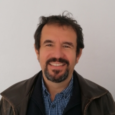
Constantin-Radu Gogu
Research Units
Disciplines, scientific fields, research areas
-
Environment & Energy
-
Circular economy
- Water in the circular economy
-
Climate change
- Adaptation and mitigation strategies
-
Earth and related environmental sciences
- Geology
- Hydrology
- Water resources
-
Circular economy
Bio
Engaged in several cities' praxis, as a member of several international initiatives and projects in handling natural hazards and climate change. Water resources expert with experience in surface water, groundwater, flood risk, geospatial analysis and software development, environment protection, natural hazards, and risk assessment. Constantin Radu Gogu is a full professor and Director of the Groundwater Engineering Centre, UTCB (Romania). He specializes in Water Resources Engineering with international experience achieved by working in different countries: Switzerland, Belgium, Spain, Greece, and Romania. He earned his Ph.D. in Applied Sciences at the University of Liege (Belgium), he worked as a Post-Doctoral Senior researcher (2000 - 2005) at the Swiss Federal Institute of Technology (ETH, Zurich) and as a Senior Researcher (2005 - 2010) at the Polytechnic University of Catalunya (Barcelona, Spain) as he obtained a Research Grant of Excellency “ Ramon y Cajal” from the Spanish Ministry of Research.
The activities that shaped his career were performed within several environmental projects with strong research components in urban water, groundwater resources, environment protection, natural hazards, and risk assessment. His current activity focuses on urban groundwater studies. He initiated and developed the Bucharest city urban groundwater model (2010 - 2019) which is currently used as a city-scale background to implement sustainable drainage systems. He is the Deputy Chair of the Groundwater Management Specialist Group-International Water Association (IWA).
As scientific and technical achievements of his entire activity, it has to be mentioned the design of the groundwater database of the Walloon region-Belgium (1997 - 2000), the elaboration of the prototype hydrogeological maps (1999-2000) of the same county, the design and the development of the first geospatial database concept for active volcanoes (ETH Zurich, Switzerland, Geowarn project, 2000 – 2004), the design and the development of the Barcelona (Spain) city hydrogeological spatial database (2006 - 2009), and the creation of software instruments for water quality and 3D geological analysis (2006 - 2011).
He has been also involved in several projects on flood hazard and flood risk management, developed within the EU Water Framework and Floods Directives, and World Bank, with complex institutional and organizational settings.
Degrees
Post Doc in Geosciences - Swiss Federal Institute of Technology, Zurich (ETH)
PhD in Applied Sciences - University of Liege
MSc in Water Ressources - International Program (Technical University of Civil Engineering, Bucharest, School of Mines, Paris, University Pierre et Marie Curie Paris VI, University of Liege, University of Genoa)
Diploma of Civil Engineer, Hydraulic Structures - Technical University of Civil Engineering, Bucharest
Projects
Alternative Water Resources and Deliberation process to renew water supply strategic planning (AWARD)
simultaneously the society, the science and the policy into the development of knowledge and strategic water planning. Therefore,
AWARD will provide evidence-based solutions to consider AWRs into water supply strategic plans, based on socio-political
engagement. The 4 Demo Cases of AWARD are already implementing AWRs (storm water, rainwater and aquifer recharge in
Bucharest in Romania as well as in Milano in Italy; water reuse in Cyprus, storm water and rainwater in an industrial park in Santiago di
Compostel in Spain). Through the project activities, Demo Cases will consider scaling up their actions taking in account a broader
range of AWRs together with conventional water resources for planning future water supply systems at local or regional level using
AWARD instruments (Local Water Fora, Digital Platform for decision making, training and guidance). They will address similar issues in
a harmonised and coordinated way. Societal awareness to support the decision process on AWRs supply solutions will lead to the
recommendations for further use of AWRs encompassing the 4 dimensions of social innovation (Technological, Capacity
development, Governance & Policy, Economics & assessment). The AWARD AWRs catalogue will gather the project results and
additional solutions which will be benchmarked. The digital platform provided by AWARD will support the exploration of resilient
scenarios that will be promoted beyond the scope of the project thanks to dedicated networking activities.
AWARD general objective is to provide evidence-based knowledge and lessons learnt on how to effectively integrate affordable,
acceptable and reliable AWRs solutions into water supply strategic planning and implementation considering the effect of global
changes.
COST-TU1206- SUB-URBAN - A European network to improve understanding and use of the ground beneath our cities
Innovation for Extreme Climatic Events (INXCES)
INXCES took a holistic spatial and temporal approach to the urban water balance at a catchment scale and perform technical-scientific research to assess, mitigate and build resilience in cities against extreme hydroclimatic events with nature-based solutions.
INXCES used and enhanced innovative 3D terrain analysis and visualization technology coupled with state-of-the-art satellite remote sensing to develop cost-effective risk assessment tools for urban flooding, aquifer recharge, ground stability and subsidence. INXCES will develop quick scan tools that will help decision makers and other actors to improve the understanding of urban and peri-urban terrains and identify options for cost effective implementation of water management solutions that reduce the negative impacts of extreme events, maximize beneficial uses of rainwater and stormwater for small to intermediate events and provide long-term resilience in light of future climate changes. The INXCES approach optimizes the multiple benefits of urban ecosystems, thereby stimulating widespread implementation of nature-based solutions on the urban catchment scale.